Clik here to view.
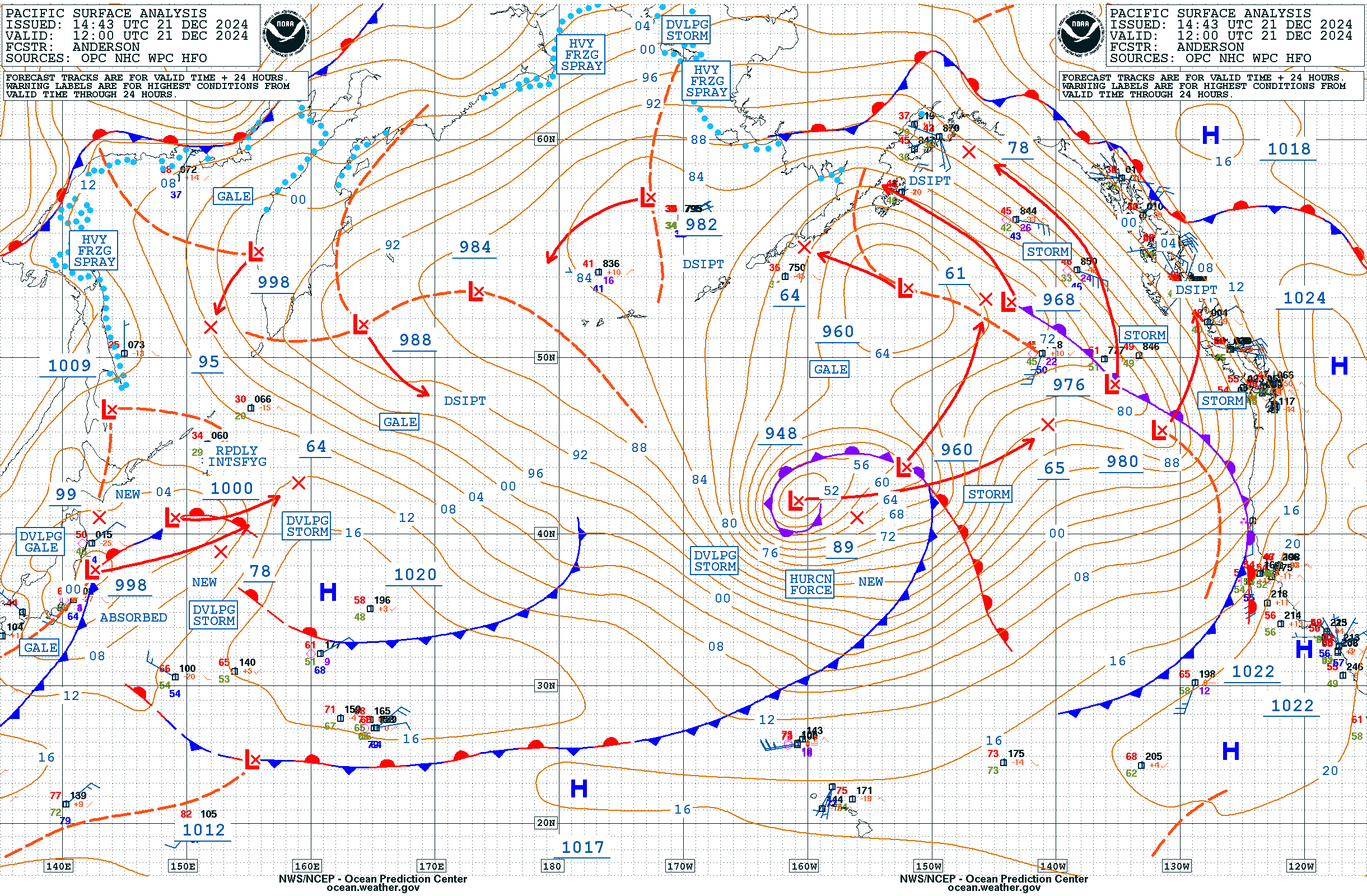
Surface Analysis
Monster Pacific Storm Unleashes Massive 65-Foot Waves
The OPC reported these measurements were captured by the Sentinel-6A altimeter within a massive 260-nautical-mile swath of “phenomenal seas” exceeding 45 feet.
LATEST VIDEOS
The system consists of a complex low with its main center at 42N166W showing an impressive 946 MB pressure reading, moving east at 35 knots. A secondary low at 42N158W with 965 MB is also present.
Underscoring the significance these conditions, the World Meteorological Organization’s current record for significant wave height measured by a buoy stands at 19 meters (62.3 feet), recorded in 2013 between Iceland and the United Kingdom.
Clik here to view.
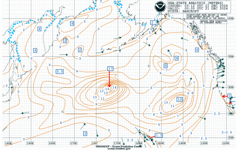
Experts note that these measurements represent only the significant wave height – the average of the highest one-third of waves. Individual waves in the affected area could potentially reach heights of more than twice the significant wave height.
The storm system is generating hurricane-force winds between 50 to 70 knots within 540 nautical miles of the primary low’s southern semicircle. Forecasts indicate the system will continue to impact shipping routes as it moves northeastward over the next 48 hours.
The system consists of a complex low with its main center at 42N166W showing an impressive 946 MB pressure reading, moving east at 35 knots. A secondary low at 42N158W with 965 MB is also present.
Underscoring the significance these conditions, the World Meteorological Organization’s current record for significant wave height measured by a buoy stands at 19 meters (62.3 feet), recorded in 2013 between Iceland and the United Kingdom.
Clik here to view.
Experts note that these measurements represent only the significant wave height – the average of the highest one-third of waves. Individual waves in the affected area could potentially reach heights of more than twice the significant wave height.
The storm system is generating hurricane-force winds between 50 to 70 knots within 540 nautical miles of the primary low’s southern semicircle. Forecasts indicate the system will continue to impact shipping routes as it moves northeastward over the next 48 hours.